CASE STUDY
Deliverables
Illustrations for
print & digital
Purpose
Wayfinding map
in the festival area
Festival Maps
Year – 2018
The maps were created under the guidelines of the organisational and design teams from the festivals.
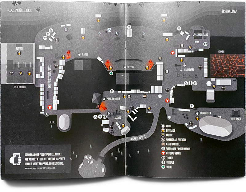
I was asked to create the maps for Copenhell and Heartland 2017 music festivals. For the first time, they trialed an integration with a new digital product, Maplify. The novelty consisted in injecting the illustrated guide, containing all details about scenes, shops and other important spaces, onto Google maps. The benefit of it was that shops could update information real-time instead of in the old ways.


Map for Copenhell
Below you can see the map through the Maplify digital map system.
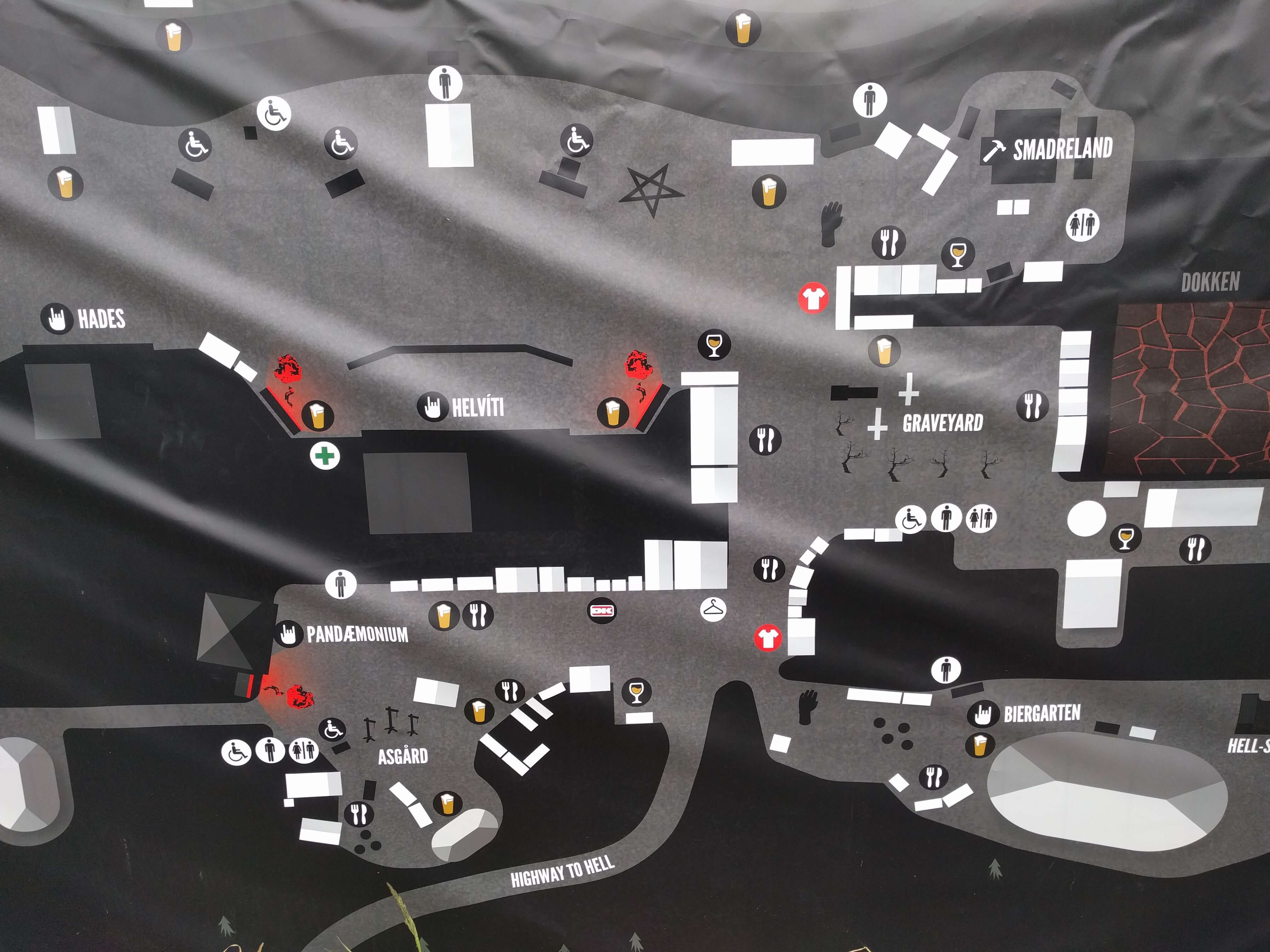
In print
The guiding map for Copenhell was also printed on a big panel for facile display and in the brochure centerfold.
Hey there, this is the default text for a new paragraph. Feel free to edit this paragraph by clicking on the yellow edit icon. After you are done just click on the yellow checkmark button on the top right. Have Fun!


Map for Heartland


Get in touch.
Get in touch.
Get in touch.
Get in touch.
© Florentina Surel 2025 - All rights reserved.


